
Archaeological heritage
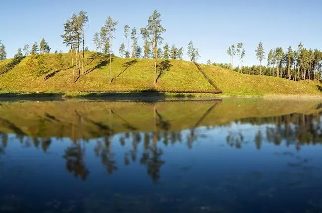
The mound is located on the western shore of Lake Mergežeris, on an elongated massive ridge surrounded by the lake and swampy lowlands. The site is slightly convex, rectangular, about 60 m length and 10 m wide. The slopes are steep, about 20 m. height. The defensive facilities of the mound consist of 2.5 m embankment below the site, on a slope at 1.5 m a high, beyond which traces of a former ditch can still be seen.
The cultural layer of the ancient settlement has been discovered on the shores of Lake Mergežeris. On the slope, a molded ceramic with a striped surface was found.
In the southeastern foothills, on the shores of Lake Mergežeris,on an area of 0.5 ha a cultural layer of an ancient settlement has been discovered. It is believed that people have lived here in the first millennium BC – the beginning of the first millennium after Christ.
It is said that there was a farmhouse on the shore of the lake where three sisters lived. Once they drowned, that is why the ice on the lake is sometimes red. It is said: “Don’t go to that lake, three girls drowned here – if the boys are swim there and didn’t drown they would be drowned..”
Contacts:
Švencionys district,
Sirvėta Regional Park
Tel: 8 387 50131
Fax: 8 387 47 524
http://www.sirveta.lt
How to get there? Coordinates 643923, 6122968 (LKS) or 26.262117, 55.221222 (WGS)